Business intelligence (BI) refers to applications and technologies that are used to gather, provide access to, and analyze data and information in order to support strategic decisions. For this reason, the BI provides tools to analyze large amounts of information quickly, and identify efficiently the changes of what is to be monitored.
Typically these tools aren't able to display on a map the analysis results but this is essential in specific contexts and for a more immediate visual impact.
These limitations suggest to integrate GIS (Geographic Information Systems) and BI (Business Intelligence), combining the potentials of both technologies.
In this scenario the BI will provide the ability to view complex analysis results on the map, and the WebGIS (GIS) the possibility to use BI tools to aggregate data.

GeoBI (GeoSpatial Business Intelligence) is the INOVA Open Source Project to integrate these two "worlds" until now separated:
- Business Intelligence (BI)
- GIS (Geographical Information Systems)
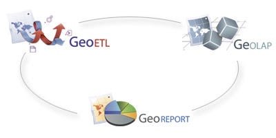
INOVA is the company leading this project and is studying and developing GeoBI as an Open Source suite composed by three major modules: GeoReport, GeOLAP and GeoETL.
The technologies on which INOVA is focused on are: JAVA for BI processes and OGC standards e.g. WMS, SLD, WFS, WFS-T, WPS, ecc.. for WebGIS components.
The products on which INOVA is focused on are: Pentaho, GeoKettle and GeoMondrian for BI-GIS integration and OpenLayers, Mapfish, GeoServer for WebGIS development.
You can found references in the "Products" and "Links" panels of this blog!
GeoBI allows:
visualization on a cartographic map of mono and multidimensional analysis results
cartographic reports generation
spatial ETL processes
GeoBI consists of three modules:
GeOLAP: to display multidimensional analysis results on a cartographic map, via Web
GeoReport: to generate cartographic reports and display charts, diagrams and indicators on the map, via Web
GeoETL: to extract, trasform and load in a DWH (Data WareHouse) every kind of data, dealing with "geometry" as a native type

6 comments:
Excellent...
Will promote it from my side:
http://pulse.veltsos.com/node/331
Look forward to see a download link ;)
Thank u very much to promote the idea on your blog!
Hi,
Why aren't you using the Spatial Data Integrator from C2C
http://www.spatialdataintegrator.com/
as a Geo ETL ?
Hi Pierre,
INOVA as a good knowledge on Pentaho suite...we have "step" customization experiences and we have planned the development of two steps, too:
1. Geocoding step (for Italy)
2. OSM step (for OpenStreetMap
data)
So..we would like to exploit our skills.
Anyway, we know that SDI has more functionalities (e.g. OSM) than GeoKettle, in fact we usually don't exclude to use it when necessary in GeoETL processes. Consider that at the present GeoBI isn't a finished product, but an open project on which work hard ;-)
vERY INTERESTING,
I WANT TO SAY HOW I CAN USE THEM FOR GEOMARKETING RESEARCH (IN ITALY).
WHAT'S THE INSTRUCTIONS?
THANK YOU
Hello Stefano,
GeoBI is a developing project. At the present we have developed the prototype for GeoReport and we are studying solutions for GeOLAP (we would use GeoMondrian, too).
We will upload a war file containing the prototype as soon as possbile with all the instructions and invite all of u to collaborate with us on the idea and possible collaborations!
U should use GeoBI also for GeoMarketing....but I don't understand what do u mean for "Geomarketing Reaseach". Could u explain us, please?
Did u refer to "Geocoding step"\"OSM step" or to GeoBI modules in general?
Anyway INOVA has experience on step customization in ETL processes towards Geomarketing applications
(geocode potential customers on the map using Open Source services), and integration with Google Earth.
If you want more details, don't esitate to contact me!
Thanks
Post a Comment